Push and pull the map in the window below to see the route in blue.
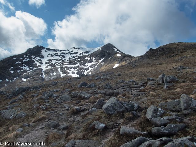
This is day 3 - there is light rain, and clouds obscure the top of Ben Starav, but in the the 3 or 4 hours it takes to get there this disperses leaving clear views all the way the the hills of Mull in the West. Snow on the northern slopes glisten in the sunshine.
At the start of the day I was pleased to know that there was just 14 kilometers of ground to cover. Now, at one o'clock, I was dismayed by the realisation that I had only covered 3 km on the ground and 1000m in elevation in almost 4 hours. The ridge ahead twists and turns into the distance with the planned camp spot beyond the furthest mountain on the horizon seeming a challenging distance away.
Planning and resolve does not compensate for fitness and not for the first or last time do I regret my lack of preparation. A walk can be more enjoyable if it is relaxed and done at a level somewhat lower than capabilities allow.
 |
| Looking back to Ben Starav |
 |
| The ridge heading eastwards with camp spot by the far horizon |
There is always some up-and-down along a ridge and without much mountain walking practice I was finding this exhausting, so I was pleased to agree with myself to stop a bealach early. Below Stob Coire Albannaich is a wide area with plenty of water and some flat land.
Orientating of the tent can be difficult in a high pitch - the back should face the wind, but on a bealach this often comes from all directions as it is deflected from nearby cliffs. Here was no exception, but fortunately the problem disappeared and the wind dropped as it became dark.
The dead grass has patterns - like runnels or routes between small holes in the ground. I've seen these before in Norway during a 'lemming year'. I wonder if they were made by this animal or another last year and now abandonded?
After a quiet night I resume my walk along the ridge disturbing a few ptarmigan on the way. The end is marked by Stob Ghabar with a scree run down to a corrie between this and Stob a'Choire Odhair from which there's a great path down to the valley.
 |
| From summit of Stob Ghabar |
 |
| Stob a'Choire Odhair from Stob Ghabar |
Victoria Bridge, a short way before the hotel, is a favourite camp spot for those walking the West Highland Way and at 4pm there are already a few tents pitched. More walkers are heading that way as I order my drink at the hotel and collect a food parcel. The hotel was fully booked when I contacted them earlier in the year and there's been no cancellations so I need to camp.
The WHW walkers is a mixed crowd, with different behaviours and expectations from 'wild camping' - for example the group I donated my extra food to had their bags carried for them from their previous stop and were loading up with beer and cocktails before investigating the campsite. Rather than move back to Victoria Bridge, I head on to find somewhere by the Loch Tulla. There's not many opportunities but I do find a spot where I can enjoy the bird life on the water in peace.
A short distance along the road is Bridge of Orchy where I find more WHWers starting their day. As I pass under the railway the sleeper train from London draws in. My route goes into the hills behind the station and suddenly I am alone again on the trail.
 |
| WHW campers at Bridge of Orchy |
 |
| Looking west over Bridge of Orchy to Stob Ghabar |
 |
| Day 4 Summit in the mist |
 |
| Tigh nam Bodach |
After 8 hours I have traveled just half the distance on my plan and some drastic countermeasure is required. Forgetting the rest of the hills for the afternoon and those on the plan for the next morning I follow the track along Loch Lyon and then the road to my FWA camp spot. The track is well made and busy with ewes and their and lambs which provide continuing interest.
 |
| At the east end of Loch Lyon - Pubil |
It is evening when I reach Pubil and the road. Here I find Sandy Millar nodding off in his distictive tent, a red Laser Competition. A short chat reveals a couple of other TGOers on the far side of the river. My planned camp spot is 3.5km further on and I head off down the Glen seemingly absent of people, but full of sheep.
Ready to drop, I reach the bridge across to where I hope to camp - to be confronted by a sign "Strictly No Camping". Too knackered to take notice I sneak over and put my tent up. I am on the edge of a small plantation which looks in poor condition and with a large dead deer lying just by the fence, it seems far from the nature reserve implied by the sign.
The fine weather continues the next day and I set off around 8, following another TGOer who I saw powering down the road across the river as I ate my breakfast. I dislike road walking, but this is pleasant in the sunshine and at one point I imagine I see an otter running along the road ahead of me before turning off to the river bank.
I miss a small diversion past Meggernie Castle which might have been interesting and after almost 3 hours on the road I reach Innerwick where to my delight is 'The Glen Lyon Tearoom and Post Office". I'm not on my planned route, so this was quite unexpected and I stop for a cold drink and a large sandwich. Strangely, although I was short of food, it didn't occur to me to buy something here until I was well on the way again!
There's a well-made track leading up over the hills to Loch Rannoch on the other side. I follow to the highest point, then rejoin my planned ridge route, heading for the top of Carn Gorm. I had been afraid these rounded hilltops would be wet and tuffety and make difficult walking, but this was far from the case. Although there is some heather to overcome on the sides, the tops are firm and carpeted with a mixture of stunted heather and moss - rather like deep pile doormat.
A hundred or more deer move across my path in three large groups as I work my way up to the ridge. When the first top comes in sight I see a human figure; good visibility means easy navigation and allows me to keep him in sight as we both move eastwards towards Schiehallion. There's 4 munros here in a group and I'm happy to traverse 3 of them, the last being Cairn Mairg.

From here I hope to reach the shielings below Schiehallion for a camp. My 1:50000 OS map does not have enough information however to guide me properly, and by the time I get out my mini Harvey Ultra map of this area with its excellent detail it is too late (incidentally the similar Glen Coe map covered my earlier ridge walk at 1:40000 too).
In the morning I quite quickly reach the wide flat area that was my original target for a camp spot. I expected to find others here but it was deserted - except for a fox trotting purposefully across my line of sight. I didn't see the cave shown on the map, and the route to the western end of Schiehallion seemed pathless. Gaining the rocky top I could see to the east some early starters coming towards me.
 |
| Shielings below Schiehallion |
 |
| Back towards Cairn Mairg |
 |
| Schiehallion summit looking east |
 |
| Schiehallion contributed to the World's understanding of Newton's Universal Gravitational Constant |
 |
| looking back to Schehallion |
There's a line of hills reaching towards Pitlochry and the gateway track takes a bit of road walking to reach. The weather is hot and the legs are weak. A rare (for me) brew is just what's needed to get me along to the lime quarry at the end of the track and Farragon hill which provided the revised target for tonight.
Below the hill are a couple of lochans which in reality are not as inviting for a campsite as the might appear on the map. As usual something works out - a flatter bit of ground appears with slighty less heather, and before long I'm cooking up the second half of my last dried meal.
I'm happy in the knowledge that I have adjusted my route enough to allow a few hours break in Pitlochry before evening time. The weather so far has been fine, so drying and adjust gear will not be necessary. Just a little bit of washing and procuring some gas are the only chores on the menu.
A few metres away is the next track and I am on the way at 8 o'clock. Within minutes I am caught up by Dean from Devon. He walked the hills south of Loch Lyon (the Ben Lawers) and started walking a few hours earlier than me. We spent a pleasant few minutes together before our paths diverges - he on the track towards Blair Atholl, me pathless toward Pitlochry. These lower hills provide fertile ground for heather everywhere, so 'heather bashing' it is for the next couple of hours.
 |
| The first view of Pitlochry |
The approach to Pitlochry is plesant down grassy slopes yellow with primulas and giant trees in Clunie woods.
 |
| Backpackers' Hotel Pitlochry |


No comments:
Post a Comment