The road to Ben Nevis Nov 2009

The road to Ben Nevis Nov 2009

Search This Blog

Saturday 21 December 2013

Cann Mill Organic Flour -time to top up

Cann Mill with the large mill pond in the foreground

The water wheel provides all the power

Enough to cover the Christmas period (and a bit more!)
 More about this special flour in an earlier blog ...


Friday 20 December 2013

Dawn to Dusk in December - A 50k walk in the Thames Valley

What will set the limit? i) Two months after an arthroscopy, will it be the knee?, or ii) With no long walking for many months will (un)fitness by my undoing? or iii) as we approach the shortest day of the year will the number of hours of daylight?

The route starts at Caversham Bridge in Reading and follows the Thames upstream west and northwards to just before Wallingford, then eastwards on the Ridgeway until Nuffield before heading south through woodland and across fields back towards the Thames and the start.

It is designed so that it can be shortened by reducing the circuit, or by cutting it short and picking up a bus which travels regularly along the diagonal red road the A4074 back to Reading.

Sunrise happens soon after 8am at this time of year, and this is a good time to start out.
Dawn mists over the Thames
Not sheep on the hill! (click to enlarge)
The Thames Path switches from one side of the river to the other. From Reading to Whitchurch it follows the south bank, but the north side is more pleasant. The paths are a little distance from the river, but the old village of Mapledurham and the llamas of Boze Down more than compensate for this!

on the Chalk cliffs between Whitchurch and Goring


Just before Goring the path is joined by Great Western Trains


The path finally reaches the river just before Goring and at the same time as the busy west bound railway line arrives over a brick bridge. With trains every 5 or 10 minutes their noise is a constant companion for the next hour or two until a much more impressive brick bridge takes the line back to the south.

Look closely - this is a wreck!

A more modest wreck!
 There are some impressive properties overlooking the river. But also some that are not in such good condition. Beyond Goring the sliver of land between the railway and the water is divided into small 'leisure' plots, which look sad and uninviting on a winter's day.
Plots sandwiched between the railway and the river
Rail bridge at South Stoke by Brunel 1834
After the prosperous village of South Stoke an impressive brick bridge moves the trains back to the other side of the river and the path becomes more rural, and quieter. A little further on is North Stoke with and impressive 13/14 century church with original wall paintings.
The church at North Stoke
Grim's Dyke
Soon after North Stoke we head away from the river on part of another national path the Ridgeway. Within a few minutes we are on a long and mysterious ancient structure called 'Grim's Ditch / Dyke'. This starts as a single embankment, but later become two banks with a deep ditch in between and stretches for about 8km beyond the village of Nuffield in the East.

Running on Grim's Dyke


Upper Grim's Dyke


South of Nuffield and Nettlebed the countryside is served by a great network of paths to navigate back towards Reading and the Thames. The prosperous Oxfordshire countryside is populated with a mixture of the old and the new - mostly well maintained properties - not all are financed by their association with the land. The attractive 17/18th century English Farmhouse is a case in point with neat stacks of cut timber for burning and surrounded by mown grass fields and many outbuildings. In one of these I found a Dave of Cobalt Blacksmiths firing up his forge while his friendly labrador sat out in the weak afternoon sunshine looking for passing walkers. There was not a horse-shoe in sight - it seems that jobs mostly come from restoration work, supplemented by domestic and artistic commissions.

English Farm
 As soon as the clock reached 2:30 it was time to reassess the rest of the journey. Walking in the dark was not part of the plan. By cutting a few corners I could trim some minutes off my journey time and a small re-route put me on paths I knew well, and could manage in the failing light after sunset. This was due around 4pm and I knew I could then count on another 30 minutes of partial daylight.
An exciting home in the woodland near Nuffield
Navigating past Stoke Row to Cane End it is still easy to avoid walking on roads. And by now the mist is rising from the fields in the dwindling light. A route familiar during daylight hours take on a mysterious atmosphere.
Path at Cane End
Mists over the orchards of Cross Lanes Farm
So the answer is iii), time was the limiting factor. I can't deny, though, that I was very pleased to take off my pack and lie down for a bit! [usually you can click on a picture to enlarge it]


Thursday 28 November 2013

Knee test: 3 walks in Wales!

It is now nine weeks since the knee operation. There's been remarkably little pain and I have been able to increase my walking distances without incident. At the 8-week check I was given the all-clear to increase distances while 'listening to your body'. Time for a trip to the mountains!

A trip to North Wales was in order. Here I could take walks over different terrain producing a variety of tests and strains on the body. I was lucky this time to be accompanied by the Native Welshman - a good help with motivation, but also handy for translating place names and filling me in with local history.

We hoped to stay at Plas Y Brenin mountain centre, but as usual it was full with course delegates and had no room for casual visitors. Out of season, there should be no problem finding accomodation and we had a great mid-week deal at Snowdonia Mountain Lodge. Configured like a motel, we had a comfortable room right next to our parked car. A twin room for two nights including breakfast cost us £90.
Snowdonia Mountain Lodge
We started from home early and got to the area by the middle of the day allowing a few hours for walking and  acclimatisation before nightfall.

One of my favorite short excursions in this area is on Cnicht. A little to the south of the main Snowdon group, this distinct hill provides an easy but interesting ascent with a fabulous unfolding view towards Porthmadog and the surrounding seascape to the south. The forecast was not good, and this was the first hill the Native Welshman had encountered in a while.
From the road up Cnicht Snowdon in the background

We marched / staggered up to the ridge below the top, buffeted by strong winds. NW had reached his physical limit and short bursts of 'face exfoliating' horizontal hale stones reinforced our decision to head back down. This was probably necessary anyway to ensure we were not night-bound on the hill side as at this time of year darkness arrives soon after 16:00.

NW identifies the top of Cnicht
This short round normally takes about 4 hours and the views are stunning with Snowdon always in sight to the north west. The round is best tackled in an anti-clockwise direction. Navigation up is easy. The route back follows the ridge which soon becomes wide and grassy and, as the paths are faint in some places, it is possible in mist to get confused about progress towards the turn which leads back down to the road.

The nearest town to the Snowdonia Lodge is Bethesda. This sad and grey place is famous for a strike by quarry workers in 1900 which resulted in a 3 year lock-out by the landowner Lord Penrhyn. The slate which used to be exported all over the globe was regarded as the world's best. There's a few shops and chippies but nowhere obvious for a meal.

We enjoyed evening meals at the Bryn Tyrch Inn just east of Capel Curig and the Vanyol Arms between Bethesda and Bangor. It is hard not to prefer the more local atmosphere of the Vaynol Arms although the food was good at both places.

On crossing the carpark to the breakfast room at the start of day 2 the air was damp and cold. The ridge across the valley where I planned to walk that afternoon was hidden in cloud. The forecast however promised clearer skies later.

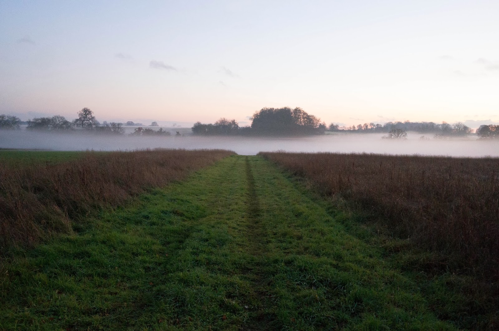
We walked directly from our room heading down the A5 a few hundred metres to join the lane linking the farms on the other side of the valley. An hour brought us to the Youth Hostel and car park at Ogwen Cottage, just beyond the point where this picture was taken.
Nant Ffrancon (valley of the beavers!?): A5 follow this on rhs to Bangor and the sea

The old stone building with toilets and hole-in-the-wall cafe has gone to be replaced by a structure in steel and wood and glass. This 'Warden Centre', although partly closed when we walked past looks much more inviting than the facilities it replaced. The toilets and a new cafe with the same staff were open and welcoming.

We continued up to Cwm Idwal and the Native Welshman reminisced about childhood picnics on the shore of the lake with grandma in high heeled shoes. On the other side we could see the route up to the ridge known as 'the devil's kitchen' with a prominent black scar known locally as Twll Du. This translates literally to 'black hole', but according to NW actually means 'devil's arsehole' or more commonly something even less polite.

The path around the lake reaches to the start of the rocky route upwards. Here we temporarily parted company. NW to socialise with the couples from Essex and lads from Poland and the proprietor of the cafe and the area warden. And me to the snowy mists enveloping the high ridge and the path to Y Garn.
A sandwich on Y Garn!

A team in army uniforms heading for the valley passed me just where the steep route up levelled out in a jumble of snowy rock. There was just one other walker to be seen all afternoon. This ridge walk is fine on a good day with views on both sides and eventually straight ahead to the sea and the island of Angelsey. The edge on the right side has some impressively steep and craggy drops down to the hanging valleys above the main valley bottom.
Looking back towards Y Garn with Nant F to the left

In misty conditions the views are not so impressive and a compass is necessary to get the northerly bearing which leads towards the end of the ridge. Here at Carnedd y Filiast the rocky outcrops are hard to relate to the map when visibility is limited and to confirm the route down I reached for the GPS. My new Garmin device with its copy of the Landranger OS maps (1:50000) did not seem to correspond with my paper OS Explorer map (1:25000).

I discovered later that more set-up was needed to allow this device to be used as I wanted.

Dropping down at the end of the ridge, the view across the Penryn quarries and Bethesda gaves glimpses of the sea and, more close by, the twinking lights of the Snowdonia Lodge complex. It is hard to find a path down and some heather-bashing is inevitable, even in good weather. Last time I was here I had failed to pack our sandwiches and two of us lingered on the slope to gorge on blueberries. Now I could see that many of the blueberry bushes had been burned.
Heather-bashing down the ridge with the lights of Bethesda and Anglesey in the distance

A short while later I reached the road, just as it was getting dark. Back at the lodge the Native Welshman was waiting to relate tales of his encounters of the afternoon. The lesson for tomorrow was to start early as there are limited hours of daylight at this time of year!

The next day we were driving back South so our time in the hills was limited. Given the constraints we searched out something new - a low-level walk with at least a little bit of excitement.

We headed for Dolwyddelan along the road from Betswy Coed to Blaenau Ffestiniog. Some good walks can be constructed here making use of the local railway to return a start point based on any of the stations on the route.
Leaving Dolwyddelan with the castle and snow-topped mountains in the distance

We left the car at the station carpark and headed up into the hills above this small town. The woodland paths were not easy to locate, but we successfully reached the moor above and crossing farmland and  forest we worked our way around to a point some distance down the river. Here we could pick-up the path which follows the railway along the river back to Dolwyddelan.

On return we noticed that we'd parked in a 'voluntary' pay-and-display carpark. Is this the only one of its kind? If you click on the picture you should be able to read the text on the sign to the left.

A very pleasant walk in varied countryside proved a good opportunity to try out the GPS as a recording device! Here's the stats:- walk length 13.5km, durations walking 3.5hours, stationary 1hour, total elevation gained 400m.

And not a single twinge in the knee!

Monday 18 November 2013

New Generation GPS? Some thoughts on GPS for mountain walking ..

What is the best GPS for the backpacker and walker? It is hard to find a definitive answer to this - I've been looking for more than a year.

Without great conviction I've settled on the Garmin GPSMAP 62s in the knowledge that it is at least better than some.

My first GPS was the Magellan 2000 XL. Probably the model was named when year 2000 seemed a long way off and full of futuristic promise.

It worked fine. When in doubt - switch it on and wait. After a few minutes it would produce the lattitude and longitude position and the translation into whatever map system was required. You needed to match this up in advance - OS references for UK, something different for Spain. As long as I had the right map I could confirm my exact location. For many years it served as a back-up and safety system. Used 2 or 3 times each year.

My next GPS was the Magellan SporTrakCOLOR.

The old one worked, so why change?  I remember an occassion in the Spanish Pyrennes amongst jaggedy outcrops of rock when map reference from the GPS and map was not enough to confirm that I had reached the top, some further confirmation was needed.

New features on the SporTrack included an electronic compass and a barometer.  The barometer provides a reasonably accurate elevation above sea-level, which itself checks against map coordinates. Belt and braces, is always good when safety is a concern. And a colour screen which could display maps. For £100 or so I obtained a UK topological map based on OS 1:50000.

The map adds another level of support - for example confirming you are actually on the path you expect to be on and not a sheep track. With a screen 5x3 cm this could never replace a paper map though, but in an emergency ... ..

Many of the GPS features are about maintaining routes and tracks. Plotting walks on the PC however and downloading them to the device is not of interest to me. I never planned to use it while walking as a turn by turn guide. For round trips I sometimes recorded the start point in case of any problem finding my way back to the car, but I have never needed to refer to this. So the Magellan worked well but travelled with me mostly as a safety device and on many trips it stays unused in the bottom of my pack.

The main shortcomings of the SporTrak is with the memory and mapping software. The device will hold a significant area of mapping, but not the whole UK. So it is necessary to switch area from trip to trip - downloading North Wales for example, or the Lake District. And although the software works fine on my old Window XP PC, I hav not managed to configure it on Windows 7.

With more time for planning walking trips, it is time to upgrade again. Since my last purchase the GPS market has increased enormously, the technology is mature and I should be able to get a fine reliable device that is easy to use and compatible with a range of readily available mapping data.

There are a couple of choices to make before zeroing in on a brand.

First a dedicated GPS or one that uses software on a mobile phone? My experience with smart phones has not been great - with too many apps clogging memory I have found reliability wanting.

More and more, dedicated GPS is delivered on a touch screen device. This gives the oem flexibility for the user interface - and reviews indicate some of these devices are very easy and efficient (quick) to operate. Using a touch screen with gloves however does not work, and this has lead me to stick with push button controls.

Garmin probably has the biggest market share, which means their customers have the biggest voice and are hard to ignore. In the absence of any negatives, I've gone with the flow - and taken a good offer from Above and Beyond for a unit including full UK OS 1:50000 mapping. (They also have some great offers on current Magellan kit).


First impressions:-

1. This is not a generational leap. On the face of it features, controls, performance are similar to my previous GPS.

2. Weight. A big disappointment is the size and weight of the unit. The old unit with similar tough and waterproof casing weighed-in at 190gm including batteries; the Garmin GPSmap 62S despite its neat appearance is big and heavy in the hand, and weighs 220gm plus an extra 34gm for the carabiner clip attatchment.

3. Mapping. The topological map on the Magellan could be zoomed to any level and was always crystal clear, whereas the OS map on the Garmin is a not-very-clear photo image of the landranger map (very blurry when zoomed in) with some street names superimposed.

4. Documentation. The instruction guide in the box is quite poor, and it is necessary to connect to a PC to access the full 60 page instruction book which is stored on the device.

5. Software. Garmin's Basecamp software seems a big plus to many users,  and some UK companies offer training courses. It will display maps loaded onto the GPS as long as the GPS is connected to a PC. It is not yet clear to me if this will be valuable as there are many other online mapping and planning tools. Integration with the GPS will be a boon to those who want to pre-load routes onto the device, but this is not a current need for me.

Let's try it in the field before making a final judgment!

Monday 11 November 2013

The Guardian does punk food?

With some spare time and a Waitrose card, I've taken to skimming over the newsprint of the Guardian (free to Waitrose shoppers).

At weekends I've found a supplement full of recipes and pictures of the most unappetising food.
 
New technology allows high quality colour printing in newpapers. The Guardian's photographers skillfully arrange the food to have a 'natural' look and capture the intrinsic shades of grey and beige, always with a few lumpybits reminiscent of vomit - either fresh-ish as above, or sickydog style as below.

Note how the carefully crafted food is offset against dirty cutlery, and junk yard furniture.

The pictures are from this weekend in November, but are typical from what I have seen over the last few weeks.

This weekend the special supplement called 'Cook' even overflowed to the weekend magazine where many more pages are devoted to brown food!

Saturday 2 November 2013

'Ere we go! TGO challenge 2014

Need to get the maps out and find the timetable for Torridon! ...


Thursday 31 October 2013

Plant Quiz #2. Do you know this flower?

That strange plant in a previous post is known as a 'Shoofly' .Thank you to a sharp eyed neighbour who spotted it at RHS Wisley a few weeks ago and remembered the name! Nicandra physalodes is apparently common on wasteland in Peru. My two specimens leaned over in the recent gales. Apparently hardy, lets see what happens next year. Even if these two plants do not survive, they have produced thousands of seeds.

Now here's another!

About 40 cm tall in the flower bed, and now looking a little worse for wear this upright plant is another that stood out amongst the seedlings grown from the 'lottery mixture'. The suprising pink flowers are held close to the foliage.
As usual you can get a closer look by clicking on the image.

Saturday 5 October 2013

Beginnings of Autumn

Suddenly there's a new perfume in the air. As other plants fade ivy is in bloom everywhere, and bees are making their last sorties for nectar. To be stored as over-wintering food.
And spiders patrol their webs on every bush.

Friday 27 September 2013

Plant Quiz - what is it!


Following the completion of the Greenhouse Project (see earlier post) I contact my favourite seed supplier and ordered their lucky dip. If you survey the catalogue of Chiltern Seeds you can imagine that their lucky dip contains some unusual items.

I bought a pack of 'lottery mixture' which contained lots of seed - maybe 700 or so.

It was late in the season to start germinating seeds for this summer but nevertheless I set to it and obtained many young plants for my efforts. As a gardening novice however I've no idea what I have grown.

This is one of the most remakable specimens. As soon as it left the pot for the flower bed it shot up. But what is it?
If you click on the picture you can zoom in for a closer look!

Saturday 21 September 2013

Commuters favourite ...

 Many hundreds moved through these blue doors every day in both directions. Week after week, month after month for many years.

But who crossed the threshold up above? What business was transacted through that brown door?


Friday 20 September 2013

Ready, Steady ... Challenge?

That giant among surgeons Mr Sean O'Leary was all ready this morning to attempt to repeat his great success in stabilising the right knee (see story in December 2012).

This time the focus was on the left side. As you can see the process starts with an arrow drawn on the ankle below. And finishes with the bandage above - or more completely with another joyful and painfree crossing of Scotland with the TGO Challenge.

This time there was no oversleeping and the pictured leg was first on the list so Mr O'L was ready to follow the black arrow at 8:30 am. Pieces were removed or smoothed or trimmed and I was in recovery 20 or minutes later.

And eating breakfast by 10am.

There are pictures taken inside the joint during the procedure, but not yet shared with me. Look at the Dec 2012 story if you want links to sensible information about the knee arthroscopy.

NHS vs BUPA? Same surgeon. Same quality surgery.

Possibly more and better equipment in the NHS. There was more paperwork and more thorough safety checking with the NHS. The competence of the support staff with NHS seemed much higher, and they were much busier. The NHS promise to deliver a solution within 18 weeks, and it is about that length of time or a little more since I first contacted my GP.

The tea and the jam with the toast was better with BUPA.  Overall the previous job took about 8-10 weeks from starting with the GP, though Physiotherapy, to Consultant to Operation using BUPA.


By coincidence the October edition of TGO magazine appeared yesterday. And, although not announced on the front cover I felt sure the Challenge application form was inside.

Perfect reading and dreaming during my few hours recovery in hospital before discharge around 12:00.

Last year I missed out expecting the October edition to appear in October and the entry to be completed soon after the end of the month.

This year we have until 26 of October to get the entry in. So buy the magazine and start dreaming now! And don't miss the deadline for entry.