The road to Ben Nevis Nov 2009

The road to Ben Nevis Nov 2009

Search This Blog

Friday 27 June 2014

High level route from Iron Lodge to Glen Affric via Stuc Mor & Sgurr nan Ceathramhnam

This was to be an exciting high level route - a reward from the tribulations of boggy ground and dangerous river crossing from the day before.
Leaving the bothy Maol Bhuidhe


My original plan - which is reflected in the map - was to camp the night somewhere near Carnach and start the day on the ridge above. Yesterday was over ambitious though and the bothy of Maol Bhuidhe was far short of here.

The morning started with a tramp over the bealach to Iron Lodge. Appearing like a oasis with trees and green grass, the contrast with the wild and rough landscape from the day before was marked. As if to emphasize the lush nature of the valley two large herds of deer were grazing in the valley, moving lazily from the edge of the track as I approached.

Two lads walked up from the Lodge having cycled in for to grab a couple of corbetts. Three hours had passed by the time I reached Carnach and started the upwards trajectory. This was to have a knock-on affect at the end of the day, curtailing my time on the ridge and the number of Munros bagged this day.
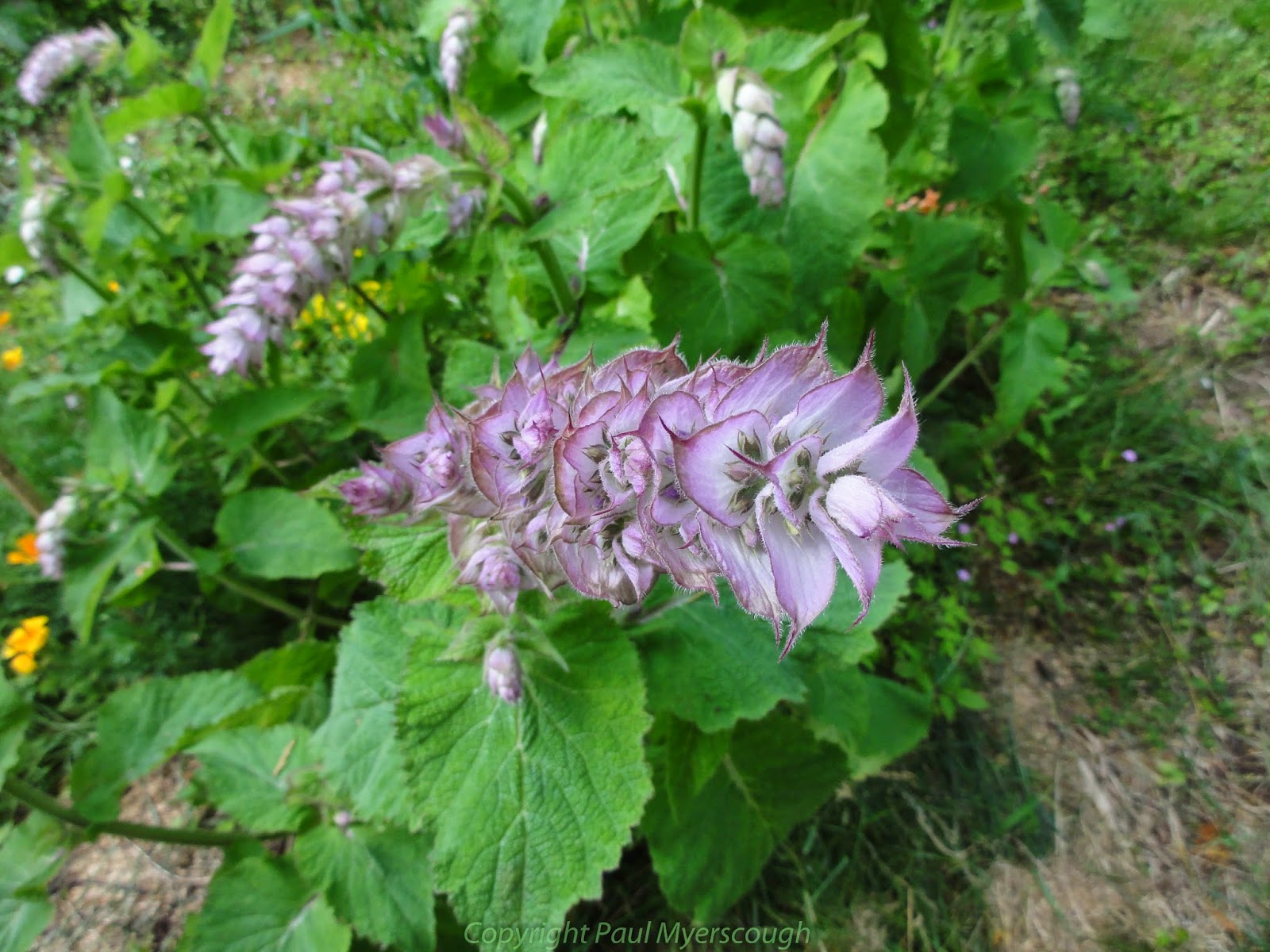
Waterfall above Carnach with landslip left of the stream

A landslip meant that the obvious route up past the waterfall was not recommended and I followed the track that headed east on the north side of a small stream. Eventually it turns and crosses the diminished stream over a bridge placed for ATV use. The track allows relatively easy negotiation of the wet boggy ground. When it levels it is necessary to strike out to the higher ground of the ridge. Beneath the wet surface of the inhospitable terrain it is possible to recognise the terracing of an old stalkers' path which brings you up to drier ground.

Once past the first top of Creag Glas the environment suddenly becomes particularly attractive with extensive views down towards the Falls of Glomach and beyond. The ridge to West Top of Sgurr nan Ceathramhnam lies ahead with an attractive flat area in the foreground dotted with lochans and rocky features.

At the top of the ridge is the north side of the West Top, seemingly covered in snow. But now it is May and the snow which still clings to the north face and the shaded corries is easily negotiated by skirting around the edge. As I reach the high point of the ridge hail starts falling, obscuring the path. The ridge which upto now has been in a North-South direction now orients itself West-East in parallel to Glen Affric.

Hail and low cloud now limit visibility but on the narrow ridge there is only one way to go, and fortunately there is little or no wind to make the airy start to this path treacherous. Now it is after 16:00 and although I have only just reached the main objective of the day, I was already thinking about where I might camp for the night. On the map there is no obvious spot for a high camp, and without great visibility the ridge ahead did not look so welcoming. I resolved to take the first escape route down towards the youth hostel at Alltbeithe.

Mam Sodhail and Carn Eighe will have to wait for another time. By the time I reached the valley bottom it was after 18:00, and I was ready to pitch camp by the river.


For the full day's pictures look here:-

Tuesday 17 June 2014

Plant Quiz! - What is it?

One of the great bargains of out time is the 'lucky-dip' seed mixture. This is a product from last years packet - one of several mysteries dominating my garden right now. What is it? Information welcome!


Flowers updated one week later .... (click to enlarge)


Sunday 15 June 2014

Craig to Maol-bhuidhe bothy via Lurgh Mohr & Bidein a' Choire Sheasgaich


This was to be the "day of crossings". Of 13 days of walking Day 2 was the one I was most nervous about. If the rivers were in spate several parts of the route could become impassible requiring long diversions. Dealing with wide and deep streams with a heavy pack and walking solo could be risky, and after many days of rain in the south of UK I was expecting the worst.
'It is quite a haul up' - Fuar Tholl from Allt a' Chonais track


The track up Allt a' Chonais differed from the map, wide in places, with new excavations created for an electric power project. Development work in the Highlands seems to require some concurrent environmental activity. Not just here but throughout my journey construction work was accompanied by 'environmental buffer zones'; here activity focussed on a vole colony.

It is a quite a haul up from the A890 main road before the track drops down to the riverside after about 5km. Here, crossing the river to open country to the south and providing access to the ridge Sgurr na Feartaig, is a double wire – the first of today's 3 wire bridges. A km or so further on another 2 wire bridge lines up with the path to Bealach Bhearnais. Here the top wire is quite slack making the whole structure uninviting. Despite my fears the river is not high and I ford it easily without water over my boots for all but the final step. When I reach to steady myself with the upper wire it gives way so much that I end up horizontal, inches above the stream, and save myself from immersion only by stepping on submerged rocks and filling my boots with water.
wire bridge #1
wire bridge #2


On the path up to the bealach I meet a couple of Scots TGOers, sceptical about the effectiveness of their Paramo gear when I noted our matching smocks. They tell me about 'some Germans' who arrived at the Bhearneas bothy around midnight. From the description I recognised my Dutch friends from two nights before - I shared a room with Charles, David, and Hendrik in the Youth Hostel in Torridon. I discussed with Charles how their plan to reach Bhearneas bothy on the first day might be too ambitious; anyway –  they made it! Near the bealach I met John Burt TGO veteran in another red Paramo smock who strongly recommended arriving in Montrose on Friday.
Bealach Bhearneas

From the Bealach the route is off-path. To the SW the ridge up to Beinn Tharsuinn is reasonable under foot. The configuration of the top though is a little hard to understand in mist and both compass and GPS were necessary to easily reach the bealach below Bidein a' Choire Sheasgaich.
scramble up a water course on Bidein a' Choire Sheasgaich
This mountain, called 'cheesecake' by many, presents a craggy end to the ridge which requires careful route finding across the terraces and a bit of scrambling to reach the top. Part way up, the scrambling looks too committing for me alone with a large pack, but by following the large terrace round to the right I found a break in the defences - a long narrow corrie which can be escaped to the left near the top.
the corrie leading to the top of 'Cheesecake'
on Bidein a' Choire Sheasgaich summit
 Thereafter the route to the top is straight forward and interesting, with a clear line along the ridge with a drop of little more than 250m to reach Lurg Mhor.
Lurg Mhor from Bidein a' Choire Sheasgaich

Down below in the distance to the south is Loch Cruoshie and a white speck beyond this is Maol-bhuidhe bothy. As it is now after 16:00 the route behind this to Iron Lodge is for tomorrow.
view south from Lurg Mhor to loch Calavie (r) and Cruoshie with Maol-bhuidhe

Dropping down from Lurg Mhor although pathless is easy going until close above the valley bottom. The final part down to the track by Loch Calavie after a long day is testing. At the end of this loch is yet another wire bridge.
wire bridge #3

This one is a model for all. With 3 wires, all stretched quite tightly walking across is easy. By holding the left top wire with the left hand and the right top wire with the right hand it is easy to maintain the centre-of-gravity of body + pack over the wire under the feet. Look here at the movie from Matt Holland (taken while I watched from the hillside above).
wet, boggy, pathless

After a long day's hike the landscape that followed was tough. Very wet, with hummocks and peat hags, and a path which fails to go in the right direction. A beeline for the bothy leads to the last crossing of the day.
Jump if you dare! Crossing loch Cruoshie outflow to reach the bothy

The outflow from Loch Cruoshie is wide and deep - the nimble can jump from the bank to the first submerged rock and thence cross on the stepping stones in place. For me this seems risky and I drop into the thigh deep water next to the bank feeling secured that the large rocks that others may balance on will stop me being swept below.

At 18:00 it was clear that I would not reach my target for the night - beyond Iron Lodge - and the welcoming bothy with the small copse and flat green field seemed a welcome oasis in a Scottish wilderness.

typical bothy - cold, dark, dirty

The bothy was already occupied by Paul Atkinson and the Peter Dixon Gang –  that is Peter himself, plus Lee Taylor, and Matt Holland. All MLD Trailstar users and fascinated by light weight gear, what better evening company could one want on a long distance walk? Peter being leader had ordered his crew to carry in some wood, and halfway through the evening he set fire to it.
Clean, warm, romantic - view provided by Matt Holland (see link above)
 The bothy has a large wooden floored sleeping room upstairs, and a small coffin-like wooden clad room downstairs which suited me fine.
back room
 For a full slide show from the day look here:-

Monday 9 June 2014

Torridon to Craig via Sgorr Ruadh and Fuar Tholl


You can pull the route map for this walk around inside the box below and zoom in and out.

Usually a click on a picture will zoom it to full screen, and there is a link to more pictures of this walk at the bottom of the post.


TGOC-0--2014011
Loch Torridon


To reach Torridon from The South we go by night train from London disembarking at Inverness on the east coast. Here a regular train crosses Scotland to Strathcarron on the west in a bit less than two hours. Once a day a small bus completes the journey north travelling around the coast for an hour.
TGOC-0--2014008
Torridon YH
Fine accommodation is provided by the Youth Hostel which is also the base for the local Mountain Rescue organisation. The free camp-site next door has access to public toilets with hot water and a shower. There are also a limited number of B&Bs.
TGOC-2014003
Loch Torridon
I started from the Youth Hostel with Sandy Millar whom I was to meet several more times on the crossing. He had been nursing an injury from some weeks before and encouraged me to go on ahead where I found Croydon Mike Hopkins recommending a slower more reflective start. Even further on I found Dave and Sue Tooth, Sue nursing a recently knee operation and looking for a spot for a brew.

The route up from Annat starts with great views of Torridon and the loch beyond. But soon the rising path turns towards the south and suddenly you are immersed in the wild Scottish mountain landscape. Probably pretty in sunshine, I was not to see this view as the rain began to fall and as I changed to waterproofs, the vista towards Maol Chean-deargh was dark and foreboding.
TGOC-2014004
Maol Chean-deargh
A clear path negotiates a route between lochans in the high valley and over first one bealach, then another to reach neighbouring Coire Lair.
TGOC-2014006
path near coire grannda
TGOC-2014008
ridge to Sgorr Ruadh
By now the rain had stopped and I followed my plan to join the NW ridge to Sgorr Ruadh. This route shows no path on the map but, on the ground, there are tracks to follow to the rocky and narrow ridge where an easy scramble leads to the top. On the other side of the summit cairn grass slopes lead down towards the base of Fuar Tholl.
TGOC-2014010
Sgorr Ruadh Summit looking N and E
From any angle Fuar Tholl looks forbidding. A dark craggie buttress dominates the north side. But beside this there is a gap in the its defences and a steep haul up the corrie brings you to the summit ridge with the highest point off to the left.
TGOC-2014015
Fuar Tholl from Sgorr Ruadh
By retracing steps to the top of the corrie and then following the ridge further to the west it is possible to work an alternative way down. The effort is repaid by good views to the south and west.
A good stalkers' path leads across the foreground of this picture,  down eastwards to a crossing point for the River Lair over which there's the path down to Achnashellach station. It was here I found a few late starters en route from Torridon including Ken Stimson who was shouting out "Nina! Nina!".  His wife had disappeared from the track some minutes earlier while they had a short break. Thinking she could have fallen and hit her head I stopped and spent 30 minutes or so searching the hillside with him, until she appeared from the path below. She had walked on ahead and apparently did not hear him calling out. I left them with their separate views on what had happened!
The station is a little way back from the road and after walking the 4km or so on tarmac to reach the other side of Craig I can recommend postponing this as long as possible. The map shows some tracks in the forest north of the road which may be worth following.
My plan was to reach open country along Allt a' Chonais, but after 10 hours walking I was happy to find a small clearing, out of sight of the development work for a power project, in the woods near Sloc Mor.

For a slide-show of pictures from this walk look here. 

Monday 2 June 2014

Great Tit - batch #2!

It's difficult to know if this fellow was here before. But anyway, in the minimum of time a new batch of chicks hatched out in the bird box. This picture is from early this morning.