

 "The lightweight alternative to walking boots, the Terroc 330 is ideal for fast and light trekking and walking in the mountains and along the trails in drier summer conditions. This shoe has lateral and medial posting providing torsional support. Recreational trail runners have also taken a shine to this superb nimble and responsive shoe." Enthusiasts in need of a new / spare pair should rush to Cotswold Camping. On sale for £54! This description from the Pete Bland website http://www.peteblandsports.co.uk is probably more accurate than Inov-8 themselves who propose these as running shoes. [See below for my sorry tale!] |
The road to Ben Nevis Nov 2009

The road to Ben Nevis Nov 2009
Subscribe To MPaulM
Wednesday, 29 December 2010
The beginning of the end for the Terrible Terrocs from Inov-8?
Monday, 13 December 2010
Scafell from Eskdale

This route to Scafell is one of the best. Long. A long trek in through the varying scenary of upper Eskdale. Now the faint paths are obcured by snow and frost, and the wide boggy area of the Great Moss is comfortably and firmly frozen.
Cam Spout, on the far side below Broad Stand and Mickledore and leading to the ridge is just a twist of frozen green ice.
Me, I chose the next indentation between Broad Crag and Scafell Pike with a diagonal upwards traverse across the front of Dow Crag then up to the cwm above Little Narrowcove.
 |
| looking down from Dow Crag |
 |
| .. and up to the Cwm between Broad Cragg on the left & Scafell Pike |
There were no footprints here until the ridge. Here the east facing slope of Scafell Pike was a hard packed slope of ice and snow with just a few old and insecure steps kick into the surface. Time for the Grivels! I'd carried crampon all weekend and this was the first time I felt the need for them.
 |
| Scafell Pike sumit pile of stones |
Lunchtime on the highest spot in England also meant that it would be dark in a few hours. My way back was over Scafell to the west, and I could make out a snow filled Lord's Rake below. In the picture you can see the diagonal white strip to the right of the mountain mass.
 |
| Scafell with Lord's Rake to right |
 | |
| start of Lord's Rake (figures at top) |
In case of mist you have to remember 'up three times, down twice' for Lord's Rake.
 |
| The final section of Lord's Rake before the left turn up to the top of Scafell |
From the top of Scafell a final look at the panorama to the east (here with Scafell Pike) before the long race down the ridge to beat approaching dark. [click to enlarge!]

Wednesday, 8 December 2010
Minus in the Lakes

I parked the car by arrangement at Eskdale YH and at around 3pm headed off up the valley. Before long the light was fading and I needed to find somewhere for the night some several kilometres short of my planned spot.
This was my first winter camp with the MLD Trailstar. This pentagonal tarp has been well-reviewed by Colin Ibbotson (review here) and is quick and easy to set up on flat ground. On typical UK mountain terrain however its a different story. Which local features can be inside and which should be kept outside? From which direction is the wind coming? And which side is preferred for the entrance?
Temperatures were down at -6 degrees during the night. The condensation on the inside was frozen, and there was frost on the outside too. The ground area covered is enormous and although the headroom isn't great except at the centre pole there's plenty of room to be quite untidy. I've made a ground sheet which covers half this area and which I slept on in the summer. This time I used a separate Rab Storm Bivi bag for sleeping on.
Key to keeping warm is an adequate clothes and sleeping bag, and a good insulating sleepmat. I was let down by my Multimat which seems to leak at the valve, so that within a short time I was lying on the cold hard ground. And there's a lot of hours of darkness in winter (from soon after 4pm until about 8 next morning!)
Sunrise was announced for 9:30, but at 8.00 it was light enough to walk. An early start enabled me to get on Crinkle Crags for a late breakfast sandwich. With Spectacular views across all of the Lake District. Looking down on the Langdale Pikes! And across the sea westwards to the Isle of Man!
From the Southern end of the Crinkles the obvious ridge route goes north over Bowfell and Esk Pike. Icy snow underfoot, but so far secure enough. My target was Pillar and following these three tops I headed from Esk Hause down past Sprinkling Tarn towards Styhead Pass and Gable. The route across the front of Gable past Napes Needle is not the easiest to follow - with a sprinkling of frost or snow on the ground the path is hard to see, and with a large pack on the back it is more difficult to follow than in summer time.
Already 3.30 the light is beginning to fade again. From Beckhead on the north side of Gable a sightly downwards path crosses the back of Kirk Fell to Black Sail Pass. Suddenly it becomes necessary to find some flat ground again.
I found a small area close to a stream just a little down from the pass. And this revealed another shortcoming of the Trailstar. This spot was like a small roofless cave with quite high rock behind and on each side. The tarp covered the area, but there was no practical way to secure it well. The pyramidic shape really requires a flat pitch, and here without a 10-foot pole the central point just flapped around in the wind which started up later in the night.
This time temperatures dropped to minus 7. And it snowed. And the wind blew the snow. And it blew it right into my 'cave' which became something of a snow drift. Fortunately the bivi bag protected the parts of me that couldn't fit under the tarp.
By daylight it had stopped snowing and after digging out my gear I found my way up onto the ridge to Pillar. Another brilliant morning with views across to most of the peaks in the Lakedistrict, the hills of southern Scotland, and the Isle of Man, and the off-shore windfarm in between.
Beyond Pillar is Scoat Fell with a small outcrop called Steeple. The cold wind and the icy rock pointed me away from this diversion and I headed back towards Wasdale over Red Pike and down besides Yewbarrow.
Although not much after 1pm I needed to plan for the night as little more than 3 hours of daylight remained. With my failing sleepmat, my dead camera batteries, and a frozen gas stove which refused to boil a second pot of water in the morning (the snow melted from the first boiling had frozen in the works below the flame including the valve from the gas canister) - I decided not to spend a 3rd night outdoors. The options seemed to be Wasdale Head Hotel or walk over to Eskdale. In the bright sunshine it was hard not to believe they'd be full at the Wasdale Head so the long walk won.
A friendly warden had met me 2 days before when I had arrived at Eskdale YH for parking the car. Now, in the dark of a Saturday night, I found a notice on the door 'Youth Hostel Closed for Winter'!
It is a strange season to look for a room in this quiet part. Most places have closed their rooms up, and run with a front bar only. I went from place to place up and down the valley. Eventually I found the Bower House - right at the bottom of the valley which was running normally. With a blazing fire a welcoming bar and an extensive menu this was just the job .. ..
Monday, 22 November 2010
The TGO Challenge Teaser

Placing on the standby list is 53. Indication is 30-40 may get placed eventually through drop-outs. So there's not much chance for next year!
As a teaser I have all the Rules, the Guidelines, a History, Route Planning Notes, and a complete list of participants. So I feel part of the club .. almost.
Sunday, 21 November 2010
Terrible Terroc - Inov-8 innocent?
I was so excited to find Inov-8's Terroc running shoes in our local Cotswold Camping store two years ago!
I had started some gentle running a couple of years earlier. Trying to keep off the road and paved surfaces to help preserve my old knees. I'd been buying trainers 'for off-road' from a nearby sports shoe specialist 'Lace-ups' and I generally found what I was given inadequate - poor grip on mud and wet grass, and before long the uppers would become detatched from the sole.
The Terroc sole looked terrific for grip, and the shoes seemed even lighter that those I was used to. So out came the wallet, and running became more rewarding. For a while.
11 months later this is how they looked!
They look over-used, but in fact this is a result of 20-25km a week on average or less. The holes developed at around 8 or 9 months and progressively got larger.
Of course I contact Inov-8. I emailed and emailed. I sent the pictures. And I never received a reply.
You expect the producer to take care of product quality, but it seems Inov-8 have a different policy. Cotswold should have some influence, but even for them - a reply to resolution took more than 3 months.
I convinced myself that the design had been modified and took a new pair last September expecting a longer life and better result.
Look at them now:-
Like the previous pair the problem developed after about 7 or 8 months so at 12 months they are unusable.
As last time I emailed Inov-8 asking for their advice. As last time no reply.
Are Inov-8 innocent of customer service? Do they care about their product in the market place? And what do they think about customer satisfaction?
I had started some gentle running a couple of years earlier. Trying to keep off the road and paved surfaces to help preserve my old knees. I'd been buying trainers 'for off-road' from a nearby sports shoe specialist 'Lace-ups' and I generally found what I was given inadequate - poor grip on mud and wet grass, and before long the uppers would become detatched from the sole.
The Terroc sole looked terrific for grip, and the shoes seemed even lighter that those I was used to. So out came the wallet, and running became more rewarding. For a while.
11 months later this is how they looked!
 |
| Inov-8 Terroc 330 - pair #1 June 2009 |
Of course I contact Inov-8. I emailed and emailed. I sent the pictures. And I never received a reply.
You expect the producer to take care of product quality, but it seems Inov-8 have a different policy. Cotswold should have some influence, but even for them - a reply to resolution took more than 3 months.
I convinced myself that the design had been modified and took a new pair last September expecting a longer life and better result.
Look at them now:-
 |
| Inov-8 Terroc 330 - pair #2 September 2010 |
Like the previous pair the problem developed after about 7 or 8 months so at 12 months they are unusable.
As last time I emailed Inov-8 asking for their advice. As last time no reply.
Are Inov-8 innocent of customer service? Do they care about their product in the market place? And what do they think about customer satisfaction?
Sunday, 31 October 2010
Marseilles in October
This in part follows from an earlier discussion about Wordpress vs Blogger.
This article was created in Wordpress, and exported. Blogger could not import the file until it had been processed by Wordpress2Blogger.com. My early conclusion is that Blogger may be safer and more flexible:- as you can see below the picture captions did not seem to work and some of the images got trimmed in the display. I did not have the same problem sending the information the other way.
Anyway Marseilles is a worthwhile for a trip!
[caption id="attachment_179" align="alignnone" width="640" caption="Marseilles Vieux Port"]
[/caption]
A first experience of Ryanair with a price for two that escalates from £80 to £160 once the non-optional extras are added (like on-line check in, card payment administration) and a couple of optional ones like one small suitcase and speedy boarding.
And then a new city experience in France. Marseilles is near a lot of places we know of, but why not start at the centre and work outwards? We can travel there again if this trip works out.
Actually this is not quite the best time to come to France. On Saturday city centre transport came to a halt as many 1000s of people took to the streets.
[caption id="attachment_167" align="alignnone" width="300" caption="Street full of garbage Marseilles October 2010"] [/caption]
And every day of our visit the streets were full of garbage.
Practical stuff:-
Ryanair with a few other cheapo airlines travels to a shed at one end of the airport called 'MP2'. Actually it is only a short walk to the main terminal. A little past this and you connect with the express bus to the town centre Station St Charles at €8.50 for the 20-30 minute journey. There is a train ticket available too, at the same price, but that journey starts with a shuttle bus to a station a couple of km away.
We walked down to the tourist office at Vieux Port to pick-up a street map and a brochure and a newspaper with a what's on guide. Not much else on offer there! For a transport map go down the metro and ask in the Accueil office - none were available when we asked.
We had already reserved in IBIS Euromediterranee http://www.accorhotels.com/gb/hotel-6190-ibis-marseille-euromediterranee/location.shtml with an offer of 3 nights at €50. Quite comfortable, with friendly service and a breakfast to our taste at €7.50 [but not the dinner which was served super fast, but tasted unworthy of a restaurant table]. Easy to reach with a 20 minute walk or a tram ride from the centre. There's no wonderful view from the window or busy local bars just outside - for that you must pay more, probably have less comfort, and be in the Vieux Port area.

The city transport is quite convenient, with an integrated ticket system. A one trip ticket costs €1.50, lasts 1 hour and you can move from metro, to bus, to tram. A day ticket costs €5. I do need a map to fully enjoy this scheme, fortunately I had printed off the PDF file before I left home.
[caption id="" align="alignleft" width="197" caption="Marseilles bus"]
[/caption]
[caption id="" align="aligncenter" width="197" caption="Metro"] [/caption]
The tourist sites are interesting but not spectacular and are described by the tourist office guide. Here's a few ...
Away from the main business of the city and next to the sea you find the Cathedral. From the outside it looks rather forlorn.
[caption id="attachment_178" align="alignnone" width="244" caption="Marseilles Cathedral"] [/caption]
Inside it is well cared for, but and not so ancient.
[caption id="" align="alignnone" width="400" caption="Cathedral interior"] [/caption]
It is quite close the port and around the corner overlooking the harbour is the very charming and much older church of St Laurent.
[caption id="attachment_180" align="alignnone" width="300" caption="St Laurent church by port"] [/caption]
[caption id="attachment_181" align="alignnone" width="300" caption="organ pipes from wind organ"] [/caption]
Vielle Charite in the old town area of Panier above the harbour is an impressive monument which was built originally to house the poor of the city. Conceived in 1622, the building was finished in 1749. Since then has had various uses for the poor and dispossessed before becoming a barracks for members of the French Foreign Legion. After a period of closure it is now restored and part is used by a couple of museums.
[caption id="attachment_203" align="alignnone" width="300" caption="Vielle Charite"] [/caption]
From many parts of the city the vista includes the hill with Notre-Dame-de-la-Garde looking over the eastern side of the old town. A 20 minute uphill walk from the harbour brings you to the most popular tourist sight in the town. Crowds admire the view over the city, and the interior of the highly decorated church from 1864.
[caption id="attachment_220" align="alignnone" width="384" caption="The back side of Notre-Dame de la Garde"] [/caption]
While interesting, it was hard to classify any of the sights as stunning. A city pass with free museum access would have made us work harder, but we gave this discount card a miss because the star attraction - a boat tour to the prison island out beyond the harbour - was stopped for a couple of months (you were offered a bar of soap instead!).
At the end of the first day we rested on a bus that took us westwards to a 'village' called L'Estaque where Cezanne had lived for some years and established something of an artists colony. We followed a trail around the houses and down to the shore - where we saw no beach just many small boats tied up for the winter. This is really part of the greater city conurbation and difficult to recognise as a tourist attraction. If you are familiar with Cezanne's multiple pictures of one crag with many different colourings and lighting - it is easy to imagine this is it - high above the shoreline beyond the last of the houses and roads.
[caption id="" align="alignnone" width="144" caption="the shoreline at L'Estaque"] [/caption]
We found a journey eastwards more rewarding. Taking bus 21 from near the old port all the way to Lumigny, we arrived by an outpost of the university, completely out of the town and high above the sea. A range of trails head off to viewpoints and along the coast renowned here for its high white cliffs and the deep blue inlets known as Calanques.
[caption id="attachment_217" align="alignnone" width="640" caption="Coast looking east"] [/caption]
[caption id="" align="alignnone" width="547" caption="Lunch down below!"] [/caption]
After a 30 minute walk we could see a tiny harbour down below. An hour or so later we had worked our way down to join the lunch crowd. Despite the bright sun the temperature was quite cold and most were eating in doors.
[caption id="attachment_216" align="alignnone" width="640" caption="Lunch at Calanque de Morgiou"] [/caption]
We managed to join up with another bus route further round the coast at Les Baumettes. Right on the edge of the Marseilles conurbation, this area was characterised by many small groups of houses or apartments with electronic gates guarding the small streets that gave access and car parking.
Also here was a very long wall with surprising figures embedded high up above the pavement. They had titles like "L'ENVIE", "L'AVARICE", "LA COLERE". At a certain point we found an enourmous steel door - then we realised this was a prison.
[caption id="attachment_215" align="alignnone" width="225" caption="L'envie"] [/caption]
Each morning there is some fish on offer at the harbour ...
[caption id="attachment_191" align="alignnone" width="300" caption="Fish stall at Vieille Port"] [/caption]
[caption id="attachment_192" align="alignnone" width="300" caption="Fish"] [/caption]
Marseilles is the home of bouillebaisse so I was looking forward to some great tasting and good value local fish cooked in this style. Unfortunately not this time. Research lead me to a few recommended restaurant - but quite expensive with prices in excess of 60 euros per person.
We had a couple of excellent dinners though. A menu of 29 euro at Table D'Olivier in Rue de Mazanod not far from our hotel (near Joliette). The final bill was a little over 100 euros for two including wine and water and tea as well as three delicious courses.
[caption id="" align="alignnone" width="328" caption="Main course at Table D'Oliver"]
Our second dinner was in a small restaurant by the old port. In Rue Casserie this place was more informal with limited choice but we enjoyed a delicious fish soup with rouilles and croutons, followed by pasta with beef and rice with sea food. All for around 60 euros for two person.
A foody institution in Marseilles is the 3 floors of seafood restaurant & shop called Toitou. Here are a whole range of Oysters different grades from different places. And a range of other shellfish and crustacians. New for me were 'violets' unfortunately not noticed before we had to rush off to the airport after a late morning snack..
[caption id="attachment_190" align="alignnone" width="300" caption="A late morning snack!"] [/caption]
[caption id="attachment_206" align="alignnone" width="300" caption="Some of the many oysters on offer at Toitou"] [/caption]
[caption id="attachment_205" align="alignnone" width="225" caption="Violet"] [/caption]
This article was created in Wordpress, and exported. Blogger could not import the file until it had been processed by Wordpress2Blogger.com. My early conclusion is that Blogger may be safer and more flexible:- as you can see below the picture captions did not seem to work and some of the images got trimmed in the display. I did not have the same problem sending the information the other way.
Anyway Marseilles is a worthwhile for a trip!
[caption id="attachment_179" align="alignnone" width="640" caption="Marseilles Vieux Port"]
[/caption]
A long weekend for some autumn warmth in South Europe.
A first experience of Ryanair with a price for two that escalates from £80 to £160 once the non-optional extras are added (like on-line check in, card payment administration) and a couple of optional ones like one small suitcase and speedy boarding.
And then a new city experience in France. Marseilles is near a lot of places we know of, but why not start at the centre and work outwards? We can travel there again if this trip works out.
Actually this is not quite the best time to come to France. On Saturday city centre transport came to a halt as many 1000s of people took to the streets.
[caption id="attachment_167" align="alignnone" width="300" caption="Street full of garbage Marseilles October 2010"]
 [/caption]
And every day of our visit the streets were full of garbage.
Practical stuff:-
Ryanair with a few other cheapo airlines travels to a shed at one end of the airport called 'MP2'. Actually it is only a short walk to the main terminal. A little past this and you connect with the express bus to the town centre Station St Charles at €8.50 for the 20-30 minute journey. There is a train ticket available too, at the same price, but that journey starts with a shuttle bus to a station a couple of km away.
We walked down to the tourist office at Vieux Port to pick-up a street map and a brochure and a newspaper with a what's on guide. Not much else on offer there! For a transport map go down the metro and ask in the Accueil office - none were available when we asked.
We had already reserved in IBIS Euromediterranee http://www.accorhotels.com/gb/hotel-6190-ibis-marseille-euromediterranee/location.shtml with an offer of 3 nights at €50. Quite comfortable, with friendly service and a breakfast to our taste at €7.50 [but not the dinner which was served super fast, but tasted unworthy of a restaurant table]. Easy to reach with a 20 minute walk or a tram ride from the centre. There's no wonderful view from the window or busy local bars just outside - for that you must pay more, probably have less comfort, and be in the Vieux Port area.
The city transport is quite convenient, with an integrated ticket system. A one trip ticket costs €1.50, lasts 1 hour and you can move from metro, to bus, to tram. A day ticket costs €5. I do need a map to fully enjoy this scheme, fortunately I had printed off the PDF file before I left home.
[caption id="" align="alignleft" width="197" caption="Marseilles bus"]
[/caption]
[caption id="" align="aligncenter" width="197" caption="Metro"]
[/caption]The tourist sites are interesting but not spectacular and are described by the tourist office guide. Here's a few ...
Away from the main business of the city and next to the sea you find the Cathedral. From the outside it looks rather forlorn.
[caption id="attachment_178" align="alignnone" width="244" caption="Marseilles Cathedral"]
 [/caption]
Inside it is well cared for, but and not so ancient.
[caption id="" align="alignnone" width="400" caption="Cathedral interior"]
[/caption]It is quite close the port and around the corner overlooking the harbour is the very charming and much older church of St Laurent.
[caption id="attachment_180" align="alignnone" width="300" caption="St Laurent church by port"]
 [/caption]
[caption id="attachment_181" align="alignnone" width="300" caption="organ pipes from wind organ"]
 [/caption]
Vielle Charite in the old town area of Panier above the harbour is an impressive monument which was built originally to house the poor of the city. Conceived in 1622, the building was finished in 1749. Since then has had various uses for the poor and dispossessed before becoming a barracks for members of the French Foreign Legion. After a period of closure it is now restored and part is used by a couple of museums.
- Vielle Charité
[caption id="attachment_203" align="alignnone" width="300" caption="Vielle Charite"]
 [/caption]
From many parts of the city the vista includes the hill with Notre-Dame-de-la-Garde looking over the eastern side of the old town. A 20 minute uphill walk from the harbour brings you to the most popular tourist sight in the town. Crowds admire the view over the city, and the interior of the highly decorated church from 1864.
[caption id="attachment_220" align="alignnone" width="384" caption="The back side of Notre-Dame de la Garde"]
[/caption]While interesting, it was hard to classify any of the sights as stunning. A city pass with free museum access would have made us work harder, but we gave this discount card a miss because the star attraction - a boat tour to the prison island out beyond the harbour - was stopped for a couple of months (you were offered a bar of soap instead!).
At the end of the first day we rested on a bus that took us westwards to a 'village' called L'Estaque where Cezanne had lived for some years and established something of an artists colony. We followed a trail around the houses and down to the shore - where we saw no beach just many small boats tied up for the winter. This is really part of the greater city conurbation and difficult to recognise as a tourist attraction. If you are familiar with Cezanne's multiple pictures of one crag with many different colourings and lighting - it is easy to imagine this is it - high above the shoreline beyond the last of the houses and roads.
[caption id="" align="alignnone" width="144" caption="the shoreline at L'Estaque"]
[/caption]We found a journey eastwards more rewarding. Taking bus 21 from near the old port all the way to Lumigny, we arrived by an outpost of the university, completely out of the town and high above the sea. A range of trails head off to viewpoints and along the coast renowned here for its high white cliffs and the deep blue inlets known as Calanques.
[caption id="attachment_217" align="alignnone" width="640" caption="Coast looking east"]
[/caption][caption id="" align="alignnone" width="547" caption="Lunch down below!"]
[/caption]After a 30 minute walk we could see a tiny harbour down below. An hour or so later we had worked our way down to join the lunch crowd. Despite the bright sun the temperature was quite cold and most were eating in doors.
[caption id="attachment_216" align="alignnone" width="640" caption="Lunch at Calanque de Morgiou"]
[/caption]We managed to join up with another bus route further round the coast at Les Baumettes. Right on the edge of the Marseilles conurbation, this area was characterised by many small groups of houses or apartments with electronic gates guarding the small streets that gave access and car parking.
Also here was a very long wall with surprising figures embedded high up above the pavement. They had titles like "L'ENVIE", "L'AVARICE", "LA COLERE". At a certain point we found an enourmous steel door - then we realised this was a prison.
[caption id="attachment_215" align="alignnone" width="225" caption="L'envie"]
 [/caption]
Each morning there is some fish on offer at the harbour ...
[caption id="attachment_191" align="alignnone" width="300" caption="Fish stall at Vieille Port"]
 [/caption]
[caption id="attachment_192" align="alignnone" width="300" caption="Fish"]
 [/caption]
Marseilles is the home of bouillebaisse so I was looking forward to some great tasting and good value local fish cooked in this style. Unfortunately not this time. Research lead me to a few recommended restaurant - but quite expensive with prices in excess of 60 euros per person.
We had a couple of excellent dinners though. A menu of 29 euro at Table D'Olivier in Rue de Mazanod not far from our hotel (near Joliette). The final bill was a little over 100 euros for two including wine and water and tea as well as three delicious courses.
[caption id="" align="alignnone" width="328" caption="Main course at Table D'Oliver"]

[/caption]
Our second dinner was in a small restaurant by the old port. In Rue Casserie this place was more informal with limited choice but we enjoyed a delicious fish soup with rouilles and croutons, followed by pasta with beef and rice with sea food. All for around 60 euros for two person.
A foody institution in Marseilles is the 3 floors of seafood restaurant & shop called Toitou. Here are a whole range of Oysters different grades from different places. And a range of other shellfish and crustacians. New for me were 'violets' unfortunately not noticed before we had to rush off to the airport after a late morning snack..
[caption id="attachment_190" align="alignnone" width="300" caption="A late morning snack!"]
 [/caption]
[caption id="attachment_206" align="alignnone" width="300" caption="Some of the many oysters on offer at Toitou"]
 [/caption]
[caption id="attachment_205" align="alignnone" width="225" caption="Violet"]
 [/caption]
Thursday, 14 October 2010
Wordpress or Blogger ??
I learned that a great feature of Wordpress is the capability to back-up your blog by exporting it. I started with Blogger a year ago. In the intervening period I've held back a bit on publishing partly because of some (minor) frustration in the original editor, but mostly from a niggling concern that all my work may disappear for good through some unforeseen Google happening.
Then I found the Google 'export' and 'import' feature. So in this respect maybe Blogger can match Wordpress. But let's test it first. I exported in 'Blogger Atom export format' to a file on my PC. This file has an XML extension so easy to look at in a browser, which I did - and none of the pictures are there (not surprising because the filesize is only 158k).
So is this exported file useful, really? Well I quick set up this account and pointed the import function at my file and the result is below! Where did all the pictures come from - maybe sucked across from mpaulm.blogspot.com? Or are they only linked to? And if so are they stored in Blogger or somewhere else?
So now I have a few more questions. Does the export really backup the total blog or just some aspects of it? And how about the Wordpress export function - is this equivalent? Or something different?
And then, all the blogs I seem to follow are not Blogger enabled. Most seem to use Wordpress. Is this because I follow Fuddy-Duddy Oldsters who are stuck in their Early Web Ways? Or are they Savvy Tech Fiends that know about the leading edge in the time when Google is the New Normal?
Is there anyone blogging to both, that can highlight the pros and the cons? I wonder.
Scotland 2011

This picture (in October) can only mean one thing:- time to do some route planning for next year's TGO challenge!
Tuesday, 27 July 2010
Skye 2010
Isle of Mull and Skye Cuillins from south ridge of Bla Bheinn
Is July always wet in Skye? Despite rain on 13 out of 14 days it was still possible to enjoy some dry hours and a get a few good pictures as well as many great walks and some interesting scrambling along the Cuillin ridge.
 I found Ralph Storer the best companion. Lots of interesting routes. Quite terse descriptions - enough to give a sense of the type of enjoyment to be found, and key directions for tracing the route on an OS or Harvey's map.
 The next essential guide for me was the SMC book on Skye Scrambles. If the weather had been better while I had company this would have lead to lots of excitement. As it was most of the joy came from reading and imagining.
 The first two books were not in print, so I was lucky to be able to borrow them. I bough the Marsh book after consulting with Chris Townsend about his new book. Both are good options. I think Chris's maybe a bit bigger in the pocket.
 This one was for reading in the hostel. Two volumes of some of the climbs in detail from the SMC.
 | ||||||
| Isle of Mull and Skye Cuillins from south ridge of Bla Bheinn |
Is July always wet in Skye? Despite rain on 13 out of 14 days it was still possible to enjoy some dry hours and a get a few good pictures as well as many great walks and some interesting scrambling along the Cuillin ridge.


Saturday, 20 February 2010
West Highland Way in November
Here is a route with a lot to offer. For me it was a chance to try out some new gear and some old bones. And both did very well. The guides attest to its popularity. But in fact out of season it is quiet - I only met one fellow walker during my 5 days on the route. There's no tough gradients or difficult route finding.
For preparation what do you need? Actually not a lot. I recommend one map and one guidebook.
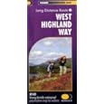 There is one map that is perfect for the job - Harveys West Highland Way XT40 . There's no point in considering anything else - nothing can match this for convenience and durability - and despite having the whole walk on one sheet it is also good for a couple of mountaineering side trips. See the review on Amazon here amazon link here!.
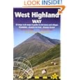 There's not much sight-seeing on the trip so the guide is mostly useful for listing accomodation or for side trips up into the hills. I used the trailblazer guide by Charlie Lorem which seem to list more places than most.
 It is small format but still quite heavy with information that you don't need on the trail. I recommend reading this in advance then cutting in two leaving the first 90 pages (on equipment, safety, Glasgow, flora, etc) behind. I found more attactive Dan Bailey's small book from the Pocket Mountains series. This is the one for side trips into the hills (and some of these will require an extra map) but also contains route information and some accomodation tips.
Highland Way sounds sort-of, well high. But actually it is a low route with very little in the way of hills underfoot, although they're all around to see. There's something called the Highland High Way which unofficially gives you what you might be hoping for, but for me this will be for a different season.
The trip fits conveniently into a week, with quoted journey times are between 6 and 9 days. For me, with bad weather discouraging any hanging around it took 4 and a half days.
My plan was to be independent, carrying a small tent and cooking stove, but ready to enjoy any accomodation if I felt the need.

A nice way to start - on the Friday night sleeper from Euston to Glasgow.


Night 1: On the shore of Loch Lomond Cashel campsite was closed to campers when I arrived, although they were still taking caravans. Reception was decorated with photos from the September floods, with the whole site under water. I was given a 'high' spot close to the entrance - the only tent on site.


 Night 2: Leaving Loch Lomond behind and after a long long wet wet walk these 'wigwam' bunk house huts at Beinglas seemed more attractive than the tent www.beinglascampsite.co.uk.
 But actually not so comfortable. Cold. Poor light. Only one power socket (choose heating or charge the camera battery). Without warning the owners had decided to close-up for the season the following day. But before this I had a welcome hot meal and a beer in the comfortable bar.
 The Way is well marked.

This handy bridge carries a small stream ... over a small stream.

Tyndrum is one of the few settlements actually on the route, and it's here you will find the iconic 'By the Way' hostel and campsite www.tyndrumbytheway.com. Shown above - the campsite is already closed and the rest is closing for the winter season. Nevertheless some friendly words and advice were available from the office.

A couple of hours later Bridge or Orchy. A couple of mountains and a hotel. And the first signs of the stag. Just an hour or so more to a comfortable bed and a warm meal ....
 Over the ridge in the fading light the car park of the Inveroran Hotel looks suspiciously empty.
 Night 3: Past the hotel, abandoned for the season, and over to the recommended camping spot. Chase deer away. Try to judge the highest and least wet spot in s semi-flooded field. And prepare the pot-noodles. And for a night to wake regularly to check the river level as the rain comes down.
 From here the drovers road to Glencoe over Rannock moor. The quietest part of the route. No cars. No buildings. Just me, the weather, and lots of deer.
 The path traverses Rannock Moor and descends into the valley that becomes Glencoe with the A82 at Kingshouse hotel.
 The landscape is dominated by a great black rock that is Buachaille Etive Mor seen here on the way out of the other side of the valey en route to Kinlochleven.

Night 4: In November all the welcoming accomodation seems closed. The Mamore Lodge only taking visitors at the weekend. The unatractive and slighly expensive Tailrace Inn full with a helpful proprieter who confirmed through several 'phone calls that the local B&Bs were closed.
A km further to McDonalds hotel was all it took to reach an oasis of warmth and hospitality. As the only hotel guest I could almost monopolise the drying room and leave the place good-as-new.

Here is the morning view from the hotel garden. Taking account of the surrounding mountains, all-in-alla place worth a return visit.

From Kinlochleven there's a pleasant path with a gradual gradient up and round the local mountain mass and then down towards Glen Nevis. Some monuments commemorate the Glencoe massacre.


The first sun of the week appears on Wedneday morning, highlighting a fresh dusting of snow on Ben Nevis.

Near the end of The Way this is the side path to Glen Nevis youth hostel.
References and links coming soon!
Gear
For preparation what do you need? Actually not a lot. I recommend one map and one guidebook.
There is one map that is perfect for the job - Harveys West Highland Way XT40 . There's no point in considering anything else - nothing can match this for convenience and durability - and despite having the whole walk on one sheet it is also good for a couple of mountaineering side trips. See the review on Amazon here amazon link here!. It is small format but still quite heavy with information that you don't need on the trail. I recommend reading this in advance then cutting in two leaving the first 90 pages (on equipment, safety, Glasgow, flora, etc) behind. I found more attactive Dan Bailey's small book from the Pocket Mountains series. This is the one for side trips into the hills (and some of these will require an extra map) but also contains route information and some accomodation tips.Highland Way sounds sort-of, well high. But actually it is a low route with very little in the way of hills underfoot, although they're all around to see. There's something called the Highland High Way which unofficially gives you what you might be hoping for, but for me this will be for a different season.
The trip fits conveniently into a week, with quoted journey times are between 6 and 9 days. For me, with bad weather discouraging any hanging around it took 4 and a half days.
My plan was to be independent, carrying a small tent and cooking stove, but ready to enjoy any accomodation if I felt the need.

A nice way to start - on the Friday night sleeper from Euston to Glasgow.

Arriving around 7am, an early train to Milngavie gets there just as the bakery is opening. A cupatea and a hot bacon roll goes down well while digesting the information on the sign board at the start of the 'Way'.

There's an hour or two of semi-sub-urbia with joggers and dog-walkers as company. Then the open countryside. A short diversion signposted from the path across a field leads to the only commercial tourist spot on the whole way. Go for it! A miniscule taste of appetising whisky, and the opportunity to spend many £s on the golden nectar [only glass bottles, so no good if you'rebackpacking lite]


Night 1: On the shore of Loch Lomond Cashel campsite was closed to campers when I arrived, although they were still taking caravans. Reception was decorated with photos from the September floods, with the whole site under water. I was given a 'high' spot close to the entrance - the only tent on site.

The walk alongside Loch Lomond can be the toughest part. Very wet and uneven under foot makes progress tiring and uncomfortable.


This handy bridge carries a small stream ... over a small stream.

Tyndrum is one of the few settlements actually on the route, and it's here you will find the iconic 'By the Way' hostel and campsite www.tyndrumbytheway.com. Shown above - the campsite is already closed and the rest is closing for the winter season. Nevertheless some friendly words and advice were available from the office.

A couple of hours later Bridge or Orchy. A couple of mountains and a hotel. And the first signs of the stag. Just an hour or so more to a comfortable bed and a warm meal ....


Night 4: In November all the welcoming accomodation seems closed. The Mamore Lodge only taking visitors at the weekend. The unatractive and slighly expensive Tailrace Inn full with a helpful proprieter who confirmed through several 'phone calls that the local B&Bs were closed.
A km further to McDonalds hotel was all it took to reach an oasis of warmth and hospitality. As the only hotel guest I could almost monopolise the drying room and leave the place good-as-new.

Here is the morning view from the hotel garden. Taking account of the surrounding mountains, all-in-alla place worth a return visit.

From Kinlochleven there's a pleasant path with a gradual gradient up and round the local mountain mass and then down towards Glen Nevis. Some monuments commemorate the Glencoe massacre.

And this sign shows that after four days the journey is almost over.

The first sun of the week appears on Wedneday morning, highlighting a fresh dusting of snow on Ben Nevis.

Near the end of The Way this is the side path to Glen Nevis youth hostel.
References and links coming soon!
Gear
Subscribe to:
Posts (Atom)