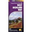
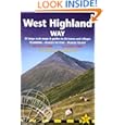
For preparation what do you need? Actually not a lot. I recommend one map and one guidebook.
 There is one map that is perfect for the job - Harveys West Highland Way XT40 . There's no point in considering anything else - nothing can match this for convenience and durability - and despite having the whole walk on one sheet it is also good for a couple of mountaineering side trips. See the review on Amazon here amazon link here!.
  There's not much sight-seeing on the trip so the guide is mostly useful for listing accomodation or for side trips up into the hills. I used the trailblazer guide by Charlie Lorem which seem to list more places than most.
  It is small format but still quite heavy with information that you don't need on the trail. I recommend reading this in advance then cutting in two leaving the first 90 pages (on equipment, safety, Glasgow, flora, etc) behind. I found more attactive Dan Bailey's small book from the Pocket Mountains series. This is the one for side trips into the hills (and some of these will require an extra map) but also contains route information and some accomodation tips.
Highland Way sounds sort-of, well high. But actually it is a low route with very little in the way of hills underfoot, although they're all around to see. There's something called the Highland High Way which unofficially gives you what you might be hoping for, but for me this will be for a different season.
The trip fits conveniently into a week, with quoted journey times are between 6 and 9 days. For me, with bad weather discouraging any hanging around it took 4 and a half days.
My plan was to be independent, carrying a small tent and cooking stove, but ready to enjoy any accomodation if I felt the need.

A nice way to start - on the Friday night sleeper from Euston to Glasgow.
Arriving around 7am, an early train to Milngavie gets there just as the bakery is opening. A cupatea and a hot bacon roll goes down well while digesting the information on the sign board at the start of the 'Way'.

There's an hour or two of semi-sub-urbia with joggers and dog-walkers as company. Then the open countryside. A short diversion signposted from the path across a field leads to the only commercial tourist spot on the whole way. Go for it! A miniscule taste of appetising whisky, and the opportunity to spend many £s on the golden nectar [only glass bottles, so no good if you'rebackpacking lite]
Night 1: On the shore of Loch Lomond Cashel campsite was closed to campers when I arrived, although they were still taking caravans. Reception was decorated with photos from the September floods, with the whole site under water. I was given a 'high' spot close to the entrance - the only tent on site.
The walk alongside Loch Lomond can be the toughest part. Very wet and uneven under foot makes progress tiring and uncomfortable.
Night 2: Leaving Loch Lomond behind and after a long long wet wet walk these 'wigwam' bunk house huts at Beinglas seemed more attractive than the tent www.beinglascampsite.co.uk.
But actually not so comfortable. Cold. Poor light. Only one power socket (choose heating or charge the camera battery). Without warning the owners had decided to close-up for the season the following day. But before this I had a welcome hot meal and a beer in the comfortable bar.
The Way is well marked.
This handy bridge carries a small stream ... over a small stream.
Tyndrum is one of the few settlements actually on the route, and it's here you will find the iconic 'By the Way' hostel and campsite www.tyndrumbytheway.com. Shown above - the campsite is already closed and the rest is closing for the winter season. Nevertheless some friendly words and advice were available from the office.
A couple of hours later Bridge or Orchy. A couple of mountains and a hotel. And the first signs of the stag. Just an hour or so more to a comfortable bed and a warm meal ....
Over the ridge in the fading light the car park of the Inveroran Hotel looks suspiciously empty.
Night 3: Past the hotel, abandoned for the season, and over to the recommended camping spot. Chase deer away. Try to judge the highest and least wet spot in s semi-flooded field. And prepare the pot-noodles. And for a night to wake regularly to check the river level as the rain comes down.
From here the drovers road to Glencoe over Rannock moor. The quietest part of the route. No cars. No buildings. Just me, the weather, and lots of deer.
The path traverses Rannock Moor and descends into the valley that becomes Glencoe with the A82 at Kingshouse hotel.
The landscape is dominated by a great black rock that is Buachaille Etive Mor seen here on the way out of the other side of the valey en route to Kinlochleven.
Night 4: In November all the welcoming accomodation seems closed. The Mamore Lodge only taking visitors at the weekend. The unatractive and slighly expensive Tailrace Inn full with a helpful proprieter who confirmed through several 'phone calls that the local B&Bs were closed.
A km further to McDonalds hotel was all it took to reach an oasis of warmth and hospitality. As the only hotel guest I could almost monopolise the drying room and leave the place good-as-new.
Here is the morning view from the hotel garden. Taking account of the surrounding mountains, all-in-alla place worth a return visit.
From Kinlochleven there's a pleasant path with a gradual gradient up and round the local mountain mass and then down towards Glen Nevis. Some monuments commemorate the Glencoe massacre.
And this sign shows that after four days the journey is almost over.

The first sun of the week appears on Wedneday morning, highlighting a fresh dusting of snow on Ben Nevis.

Near the end of The Way this is the side path to Glen Nevis youth hostel.
References and links coming soon!
Gear


No comments:
Post a Comment