The road to Ben Nevis Nov 2009

The road to Ben Nevis Nov 2009

Search This Blog

Wednesday 29 June 2016

TGOC Plockton to Redcastle Lunan Bay - #3 Feshie to the coast

"Is anyone planning to go up onto the Cairngorm plateau in the morning?" I asked the crowd gathered around the fire in the bothy. No takers.
Track looking back towards the Feshie

Just a little to the north is a track which covers a lot of ground in 8 or 9 km to over 900m high. This is easy Munro walking. The lingering snow which worried several other TGOers presented no obstacles that could not be circumnavigated, and it was an easy march over Tom Dubh to the rather featureless top of Monadh Mor.


Push and pull the map in the window below to see the route in blue.
 

The flat top of Monadh Mohr

Beyond here is the slightly more shapely Beinn Bhrotain. The path south to the top disappears, dispersed in a large mound of rocks, but once the cairn is reached the views are tempered again by the broad and flat summit.
On Beinn Bhrotain
The way to the south is pathless but pleasant and easy going in a zig-zag fashion around the subsidiary tops all the way down to Cairn Geldie. Here is a fine view up the Dee towards Devil's Point and over White Bridge towards Mar Lodge. It was with great satisfaction that I had finally traverses this corner of the Cairngorms - it has featured on my route twice before when weather or fitness has forced me to keep low.

Looking towards Devil's Point from Cairn Geldie
I joined the track beside the Dee and before long met Dave 2 again - sunbathing and talking with another challenger preparing to camp at the bridge. This was too early for me and I determined to walk on. Before long I was almost at the road and the Linn of Dee.
In the last plantation before the bridge, down by the river I found Darren Fowler and Stuart Dixon. I pitched my tent nearby, and then went on to explore the 'Linn'. This is quite a remarkable narrow gorge - the river, perhaps 20 or30 metres across is suddenly constrained as it approaches the bridge to less than a metre. I was pleased to see this for the first time on the forth trip past here!

The carpark a hundred metres along the road is useful for its toilets!

Mar Lodge used to offer rooms, meals, and camping to TGO walkers. Now it is taken over by other kinds of hospitality. The TGO is still welcome is consigned to a meeting room by the stables where a tea urn is placed. This year and last year I passed by around 9am to find the place locked up. Not one to wait around I moved on to Braemar where I knocked on doors looking for a room. Eventually I succeeded.

After stocking up with fruit, I spent the afternoon cleaning up - first me, then my clothes.
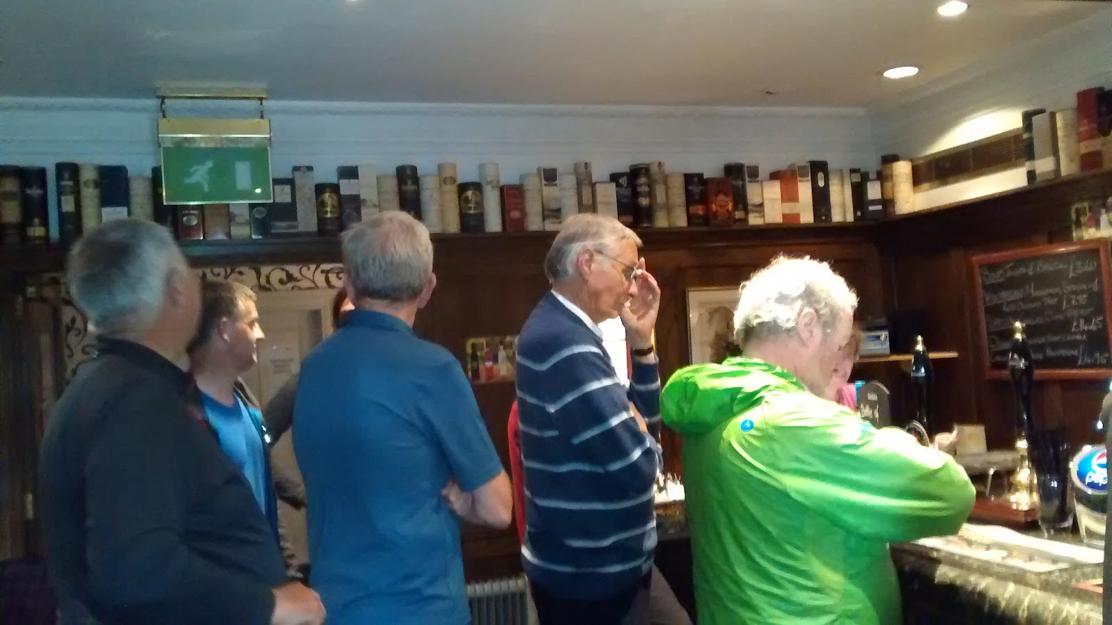
Bar with man in green
I found the two Daves were in town and we shared a table for food. As the bar became busier I headed of to St Margaret's church for a concert.


This is one of four churches in Braemar and surplus to requirements for worship so the local population are trying to establish it as a regional arts venue. A pair of pipers marched in to start off the proceedings. The host was Fiona Kennedy. She brought along Paul Anderson - said to be the Queen's favourite fiddler and probably Scotland's finest, and Beth Nielsen Chapman who was running a song writing workshop nearby. In support was Nils Elders a young Dutchman, very talented according to his wife who sat next to me in the audience, and singer Alistaire McDougal. A great variety of music in the folk idiom, some enjoyable sing-song to join in, virtuosity on the fiddle and interesting stories from Nashville; and free wine and tea and coffee included before the concert as well as in the interval. Here's a short film someone took and another.


An early Sunday breakfast and then off along the road to the golf course, which eventually leads to Callater. There's always someone in front and when I reached the road I found two or three already heading towards Lochcallater Lodge.

The shore of Loch Callater

Push and pull the map in the window below to see the route in blue.
 
The weather forecast was generally good so I was confident to head to Lochnagar on the path behind the Lodge. A cuppa and biscuit with Iain and the rest of the company there was an enjoyable break, and it was nice to hear some of the same jokes as last year!
Looking back toward Lochcallater Lodge

The path make a easy upwards traverse across the hillside, but skirts around the first Munro which requires a diversion - to follow the fence posts - to reach the twin tops of Carn an t-Sagairt Mor. The summit of Carn a' Chiore Bhoidheach is flat and less interesting than the crags of The Stuic with their view down to a Lochan.
One of the two summits on Carn an t-Sagairt Mor

Across the void are the two high points of Lochnagar Cac Carn Mor and Cac Carn Beag. To the north rain showers moved from left to right across the hills. These tops are the target of day walkers from several directions. Here were handbags and high heels, trainers and bikini tops among as well as the more serious walkers.
 
CacCarn Beag

What can I see? (from Cac Carn Bheag)
Heading down I joined John Wright from Dundee. Although a first timer this was his back yard and he had reccied the route a few weeks earlier. We had the same destination - the bothy at Shielin of Mark and with John as the guide our navigation was perfect.
Cac Carn Bheag


Before long though the distant showers we had seen earlier were upon us and we arrived at the bothy in pouring rain. 3 or 4 tents on the flatish ground next to the bothy were firmly closed up with their residents inside and the beds in the bothy were taken. The ground by the river was not so inviting in the wet. Soft and very wet; anything dryer was hummocky. After much indecision I pitched my tent and tried to dry out.
John Wright finds Sheilin of Mark bothy
 

By morning the sky was clear, the river had not flooded its bank, and I was first of the campers on the road. My route plan showed me following the Waters of Mark as I did on an earlier challenge, but on the day I followed the more direct option along Glen Lee.
Lochnagar from Muckle Cairn
Guarding Glen Lee


Arriving at Tarfside on a fine dry day was a new experience, and tea, fruit, and a bacon roll were all welcome. There were even rooms available, but I was happy to camp and after a while went down to the green with Shap McDonnell to put up my tent. Shap has the same design tent as me but in a different material.
Camp Tarfside

from Gordon Green
Dinner at St Drostans
 I took the simple evening meal on offer from the team at St Drostans of home made soup, baked potato with chilli sauce, and cake and tea. When I returned I found another similar tent parked next to mine - and there was Colin Ibbotson the designer and fabricator. Mine was the only silnylon version of this tent in the wild, and I was pleased to report I was very happy with it.

Tarfside Freemasons club
The Freemasons was open for TGO socialising as usual. A can of beer or a dram of whiskey. Or a glass of wine for those that wanted it.

Dalbrack bridge

Push and pull the map in the window below to see the route in blue.
 
From here I wanted to go south. To cross the river it is necessary to backtrack a couple of km up the valley to the bridge at Dalbrack as the nearest one is blocked; it's a significant diversion to get back to the path which heads due south from Tarfside on the map.

Estate bridge at Tillbardine
At this part of the challenge the brown hills are all very similar with landrover tracks and furnished with shooting stations. My route took my to Tillybardine where I crossed the road, then up the steep track onto the ridge heading SW to Mondurran. Then a line on the map heading for the farmland to the south.

4 young boys looking for attention
I had identified a camping spot on the 'hills of Finavon', but before I reached there a small hotel appeared. It was hard to resist, and I settled into the tiny room before joining some business travellers in the restaurant for beer and homemade steak pie.


Moving on from here to the coast it is impossible to avoid road walking. Paths through woods and on over farmland are sometimes moved or missing altogether, so off-road navigation can be frustrating.


Push and pull the map in the window below to see the route in blue.
 
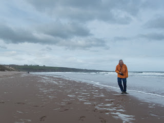
After some research I'd found a campsite at Lunan which looked attractive with a friendly sounding cafe and nice facilities. As I arrived however the cafe was closing, and there was no-one on the campsite. A quiet end to a good crossing.

I pitched the tent then climbed the large sandhills to look down on the wide shore of Lunan Bay. As I did this a minibus arrived and out bundled a number of students with surfboards. It is said that this beach is rich in semi-precious stones and although I didn't find any myself the rock in the cliffs at the end looked rather unusual to me.
.. .. .. to coast

Surfer on Lunan Sands

Redcastle remains at Lunan Bay
Looking for Gemstones


When I returned to the campsite next to my tiny tent was another. Markus Petter from Austria was standing there in admiration. He must have such a tent it was wonderful!

We parted company in the morning, he heading for Montrose for breakfast while I wanted to pass by the lighthouse at Scuddie Head. This is a pleasant enough walk in good weather and took my past an unusual family cemetery on the cliff top, and the TGO monument by the lighthouse.

Cliff top cemetrary
Scudie Lighthouse
First view of Montrose with TGO monument
Opposite Montrose is Ferryden which with some interest along the shore including washing lines over the see and information about the old communal craphouse.


Ferryden washing lines

Sign-in tea and biscuits Park Hotel


Saturday 25 June 2016

TGOC Plockton to Redcastle - #2 Cougie to Feshie


 Cougie is writ large in the history of the TGOC so I was a little surprised it was not busier. Most TGOers arrive here on the Saturday however, and anyway time has moved on and some of the people there have changed. My trip notes recorded 'fantastic bird calls' at the camping site here.

The place is quite remote, so to be kept awake by music until after 1am is strange experience and probably new in TGOC history!


Push and pull the map in the window below to see the route in blue.
 
This did not impede my morning start and a little later than Dave I packed my tent and headed over the hill to Torgyle Bridge. We'd been led to believe that beyond the watershed was a pathless and boggy wasteland to be negotiated before the comfort of a path in the forest which adjoins the road. In fact this was far from what we experienced.

Gate to nowhere - the watershed above Cougie
The hillside was dry and provided easy walking, but once on the path in the forest all progress was frustrated by a huge area - approaching a kilometre square - of fallen trees. The only way was around at a cost of an hour or more delay. I heard that TGOers got completely lost in this jumble of timber and although a satnav provided useful information it does not help climbing over the obstructions.

The road to the bridge is marked with new and smart houses, widely spaced and mostly empty. I  found a local resident from the West Midlands who confirmed that they are mostly holiday homes and largely bought for investment - many changing hands after 6 months or so.


Beyond here is a march up and over the hill to reach Fort Augustus. Already en route are several lines of electricity pylons, and the service road which starts near to the bridge is hard to ignore. This is one of those TGO highways which are not so interesting or pleasant. Near the top the road is joined by General Wade's Military Road.


After a day of trudgery the last kilometre into Fort Augustus is charming with mixed woodland and an abundance of wild flowers and birdsong.


The campsite here held much promise with a bar and restaurant - but these were unfortunately closed. The village however provides a couple of pubs and restaurants enough for TGOers' needs and there is a garage shop for supplies open until 8pm.

Here I learned again - as I do most years - that two sessions of a dryer machine in the launderette is not enough to dry one pair of woollen socks. One sympathetic TGOer Sheila advised putting the socks on my walking poles in the morning for a couple of  hours - that did the trick and by lunchtime they were dry.

We were about 10 on the small field and were much entertained by the bird population. They went about their business as if we didn't exist - popping into tents to explore for tidbits, and leaving their mark.


Push and pull the map in the window below to see the route in blue.
 

At 7:45 I was one of the first to leave, passing opposite the entrance a patch of woodland impressively abundant with handsome ransoms (wild garlic).


South from Fort Augustus is a path obvious only to me it seems, and I headed alone up Glen Tarf as I did on my very first challenge. This quiet track is banked with wild flowers and runs past a picturesque waterfall, and over some old stone bridges eventually leading to an abandoned and ruined settlement.

As the valley swings round to the east I continued up hill to the top Meallan Odhar and over to the military road so beloved by TGOers.


Here I found two other early starters resting and admiring the electric pylons. They were puzzling over their map which showed the pylons above the road, when they were very obviously below. To help them out I consulted my map - this showed two sets of pylons one above and one below. Also wrong!

Melgarve Bothy & Nik in the distance
Whatever, marching alongside pylons is not my favourite place to walk and I headed over the watershed and started the downward route towards Garva Bridge. Below, travelling very slowly I found another early starter Lindy Griffiths who seemed in trouble - a chat confirmed that she we not in need of help and she followed me into Melgarve Bothy for a cuppa a short while later. I arrived here with Nik Lawcock; Kirsty Patterson arrived shortly later having tried to walk along the 'parallel roads' above River Roy. Next came Lindy and as I was leaving first timer Paul Southward from Southend turned up.

The Iain Sheilmobile
There were lots of deer here on both sides of the track down to Garva Bridge and at the bottom, in the parking place, was a small camper van with the big and welcoming frame of Iain Sheil at the door. Another cuppa is always welcome; and a chat with Iain and giant ham sandwich doubly so. He was spending a couple of nights here meeting some friends on their route and welcoming any other TGOers that were aware enough to notice him. Apparently several had walked past oblivious to
his TGO sign beside the road.


1-2 km further on is Glenhero lodge, here I took off to the south to camp at the edge of the plantation overlooking Glen Shirra. A large flock of deer grazed on the other side of the fence and the view towards the loch and the hills beyond made a pleasant backdrop.

Push and pull the map in the window below to see the route in blue.
 

Laggan with Electricity


Laggan without Electricity
A good path leads towards Kinloch Laggan with beautiful views of the lake spoilt by more electric pylons. I headed to the bridge near Inverpattack Lodge in order to investigate Pattack Falls. Both the falls and the Linn of Pattack were impressive after rain during the night.
Looking towards Inverpattack

Pattack Falls
My target is Dalwhinnie so from here I headed east on a path which takes me almost all the way the rising ridge of Meall Liath. My vetter made some intriguing remarks about Dirc Mohr which features here near my route and I determined to investigate.

Linn of Pattack
Dirc Mohr is a narrow sloping canyon a kilometre or so long between two parallel cliff faces. Imagine both cliffs have been used for artillery practice - over a period of time - so much of the facing rock lies fractured and jumbled in the base of the canyon. Although pointing in the right direction this is hardly recommendable route to Dalwhinnie. The rock are covered with different grades of lichen  and in the wet some are treacherously slippy. The route is committing with no let-up for the whole length. Slow and careful going.


Once through, a kilometre or more brings you to the track down to the valley and the road.

The bunkhouse and cafe at Dalwhinnie is a welcoming spot with a bit of a holiday atmosphere. 10 or so TGOers rested here - some camping, others using the bunkhouse. Ron and his wife provide great hospitality and good value food and drink. They had a wall of resupply parcels that people had sent for collection and they even sourced gas canisters for those who requested it.
Ron opened the cafe early for the TGOers on Thursday morning with a big table laid for breakfast. An extra kilo or so in the stomach feels better than an extra kilo in the pack!

Most were heading towards Glen Feshie from here. In ones and twos people left for the path alongside the water viaduct which led into the hills to the east. This is reached to the south of Dalwhinnie - al little different from the planned start shown in the map below.


Push and pull the map in the window below to see the route in blue.
 
I soon caught up with David (Aylemore?) & David (Poole?). We walked together a short way until their paths divided. I continued little further, but lost the second Dave as he stopped to brew tea. As rain started Julie Harle came powering up the hill. We had the same idea - to navigate over the top and drop down to Gaick Lodge while many of the other chose a lower path further north.
Julie Harle in the mist
  We joined forces to find the route. In mist and cold, cold rain we used compass and GPS to keep us on track. After more than an hour of walking blind Gaick Lodge and the loch appeared through the mist below.
Gaick Lodge appears below

My apprehension about crossing the river was unfounded and we reached the other side with dry feet. Time to find shelter and a bite to eat. We found a small plantation nearby, but no sooner did we get our packs off than a Landrover appeared and the offer to use one of the sheds by the Lodge. Actually just as cold and also dark but we thanked them graciously before heading off again.

Now we went north then, beyond the loch, we sought out a path to the east to take us across to the dam on Allt Bran. Here we found Dave 2 seated by the wall eating his lunch.

This valley was strangely busy for such a remote place, with walkers, photographers, campers and not all on the TGO challenge. Soon we were on a track which lead down to the River Feshie and around 4pm we passed above the location of the TGO Cheese and Wine Party. We weren't sure if it was a tent down there by the river or a rock - young Julie's eyes were not much better than mine - so we walked on by.

We passed several wild horses on watch as we approached the river. Here it was necessary to remove boots before crossing. The water was cold but not too deep JH charged ahead while I tried to follow BMC guidelines about river crossings. It is always good to finish something like this when it has been hanging over you all day as a Big obstacle! For Julie this was not the end however as she had mislaid her gloves and I advised her to go back and find them. She crossed the river again, and of course once more having not found them. They were in her pack all along.

On her third crossing she came back with several young men she had found doing their mountain leader training. And then came Dave 2 from Dalwhinnie. To the north we could see smoke rising from the chimney at the Ruigh Aiteachian bothie, and before long we were joining several encampments around the building in this very pleasant spot, and chatting with the large group sitting inside by the fire.